P.O. Box 822 Golden, Colorado, 80402
SOUTH NEIGHBORHOODS - FUTURE OPEN SPACE AND PARK
Introduction
The City of Golden owns 19.99 acres of mixed-use open space located on the south end of Heritage Road. The land is bounded by Heritage Road on the West, Colfax/US 40 on the south, Zeta Street to the east and local neighborhoods to the north. It is the historic property of Joachim and Marie Binder’s family (1864 – to about 1915) and the Albert Bachman family (1938-2018). This site is visited at different times during the year by the Golden elk herd.
Present and planned uses include urban open space, neighborhood park, flood control, West Colfax trail extension, and preservation and interpretation of the historic structures.
There is one social trail that connects Heritage Road to Zeta Street.
Content contributed by Preston Driggers

coors tech wetland open space
Introduction
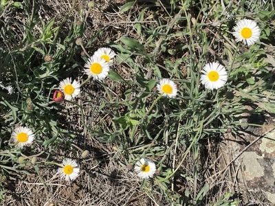
Coors Tech Wetlands Open Space consists of 8.3 acres and is the largest wetlands the City of Golden owns. It is visible from the west side of McIntire Street between Table Mt Parkway and 50th Avenue. While water drains into the wetlands from streets within the Coors Tech complex there may be other sources as well. Half or more of the wetlands is a cattail pond with other water loving plants.
Coors Tech Centers Owners Association owns the land around the wetlands. Boundary delineation is not visible.
There are no formal trails, however there are some social trails near the Montessori school and one that heads east towards McIntire Street.
The Wetlands attracts various wildlife to drink and seek prey and also serve as a bird habitat that includes red-wing blackbirds.
Other cities have built wooden walkways into wetlands with educational signage addressing wildlife and sighting general information on the importance of wetlands. This wetland open space parcel has potential to serve as an educational resource for both the Cornerstone Montessori School and the Fairmount Elementary School directly across 50th Ave as well as for Golden residents.
This discussion includes references to maps that can be downloaded at the bottom of the page.

cottonwood natural area open space
Introduction
The Cottonwood Natural Area Open Space is 1.78 acres and located behind Golden High School and bounded by adjacent neighborhoods of Harmony Village, Cottonwood and Homestead as well as Fossil Trace Golf Course. A wire fence separates the open space from the High School. No residential fences appear to border the open space. Kinney Run Gulch is adjacent to this open space on Golf Course managed property. The property slopes somewhat into a bowl that angles down south to north. The lower section of the property may serve as flood control for Kinney Run. With established trees and other vegetation, the openness of the terrain provides a nature experience for residents bordering the area.
There are no formal trails, however one neighborhood social trail does enter the site.
The site includes, and is surrounded by tall established trees, shrubs and grasses that encourage bird and small mammal populations. No plant inventory has been made of this open space.
This discussion includes references to maps that can be downloaded at the bottom of the page.

GRANT TERRY trail open space
Introduction
The City of Golden owns 3.59 acres along the north side of Clear Creek and south of US 6. The land is adjacent to
Jefferson County Open Space’s Peaks to Plains Gateway Trailhead. This Open Space includes the .6 mile Grant Terry Trail that ends at the Church Ditch head gate. Along this trail, there is a set of stairs leading up to Jefferson County Open Space’s Peaks to Plains Trail, which is now being rebranded as the "Clear Creek Trail". The open space is characterized by being heavily vegetated with established trees, shrubs, and grasses.
Although the Grant Terry Trail is proximal to US 6 and there is an active use of the Peaks to Plains Trail by hikers and cyclists, there is still a good nature experience for trail walkers due to the sounds and sights of Clear Creek. Adding to the experience is the scenic views of the towering geology of the Foothills. At night, it is quite possible that the trail is used by local wildlife.
heritage dells and tripp ranch meadow open spaces
Introduction
This is a combined 5.91 acres comprised of three gulches, namely South Heritage Dells Gulch, North Heritage Dells Gulch, and Tripp Ranch Gulch. These gulches form one of the headwaters and collection systems for the Kinney Run waterway that flows into Clear Creek near the Miller Coors Brewery in Golden. The set of east facing gulches were formed over thousands of years by seasonal rainfall and snow melt that eroded away sediments from the geologic uplift that occurred during the second building of the Rocky Mountains that included todays Front Range foothills.
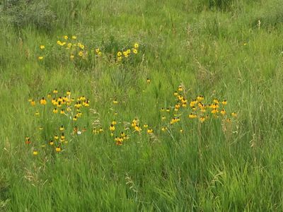
The gulches serve as visual and physical buffers within and between neighborhoods of Heritage Dells and Tripp Ranch. These are mostly linear riparian zones and as such provide habitat and corridors for local wildlife. Reported wildlife in and around these gulches include white tailed deer, elk, fox, coyotes, bull snakes and rattle snakes and on occasion, bob cats, brown bear, and mountain lion. Low level water flow, which serves the needs of wildlife, is almost always present.
The water shed for the three gulches include the sloped Jefferson County Open Space land above the two neighborhoods as well as private and public property higher up to Lookout Mountain neighborhoods. Water flow rates vary with the number and intensity of summer storms and the volume of spring runoffs. Because they are steeply angled these sloped gulches are subject to erosion and therefore access is prohibited.
No recent inventory of plants has been conducted in the three gulches. Due to subsurface water retention and often low volume trickles of water that often go unnoticed, gulches establish unique ecology supporting a variety of different plants than the surrounding grass and shrub land.
The grasses and shrubs that are outside of the water channel can be characterized as “Foothills Shrub and mixed grass prairie,” but a more detailed investigation is required to know exactly what plants are growing in the gulches themselves.
This discussion includes references to maps that can be downloaded at the bottom of the page.

Photo by Tom Schweich
illinois street open space
Introduction
The city owns 0.32 acres of neighborhood urban open space that is located at the east end of the public vehicle access on Illinois Street. The eastside of this open space includes a small piece of the city owned Fossil Trace Golf Course
Acquisition of this city land was spearheaded by the residents of Harmony village, as described by Edee Gail (1). They recognized the unique 360 degrees scenic views from the top of the knoll on the property. The resident group was able to get the housing developer to offer the parcel at market value to the city and the Harmony Village residents contributed landscaping improvements. There is a short, winding dirt trail to the top of the knoll.
Non-native grasses grow on the site. City water is available. No formal vegetation assessment of this open space has been conducted. Residents report seeing the Golden elk herd in the winter as well as coyotes and some birds.
The Open Space is located just east of the actively mined area of what used to be the Rockwell Clay Mine, operated by the Parfet Family. It sits on the geologic unit called the Arapahoe Formation, a river-formed conglomeratic unit that represents the very first uplift of the Rocky Mountains farther to the west, in late Cretaceous geologic time (around sixty-eight million years ago).
Various parts of the mine area, especially near the Triceratops Trail, were opened around 1900. After WW II, the mine expanded into the area of what are now fairways of Fossil Trace Golf Course, just to the immediate west of the park. Being able to buy surplus WW II equipment like the steam shovel still scattered across the golf course, made it possible to do open pit mining. The clay was used for brick and sewer pipe. The Rockwell Mine operated until about 2002 when the area was transferred to the City of Golden for the golf course (2).
The Rockwell Clay Mine area is located within the slightly older Laramie Formation, which was a coal swamp in a delta, much like in Louisiana today. Dinosaurs once roamed the landscape (3).
The knoll is above the roof tops of nearby homes which allow for views of the Foothills, and North and South Table Mountains. As reported by the residents, the site is a good place to view the night sky.
This urban open space provides a sense of place. As reported by a resident, it is a place where there is quiet, and one can sit and be alone to contemplate and just enjoy the outdoors.
References
(1) Gail, Edee. (2005) “Preserving Open Space—And My Humor”, in David Wann, (ed), Reinventing Community: Stories from the Walkways of Cohousing, Fulcrum Publishing, Golden, Colorado.
(2) E-mail communications with geologist, Donna Anderson. Further, the open space parcel was bought by the city from the Jefferson Clay and Investment Company, one of companies owned by the multi-generation clay mining Parfet Family.
(3) E-mail communications with geologist, Donna Anderson. See also, Anderson, Donna S., and Paul B. Haseman (2021). Golden Rocks: The Geology and Mining History of Golden, Colorado. Published Golden, Colorado.
This discussion includes references to maps that can be downloaded at the bottom of the page.

parfet open space
Introduction
The City of Golden owns 13.67 acres of open space that wraps the west end of the Parfet Estates neighborhood overlooking 6th Ave. The land is bordered by 6th Avenue right of way and the School of Mines Open Space land that serves as a landing site for hang gliders.
An unmarked trailhead on Parfet Estates Drive leads to a social trail from the neighborhood to the Chimney Gulch Trail located on Jeffco Open Space land. This trail continues upward to Windy Gap on the Lookout Mountain Road. The site is highly disturbed land with no notable vegetation, no distinctive geological features or wildlife habitat.
From the site, there are excellent scenic views of the northern Foothills and views through the Clear Creek Valley beyond the Table Mountains.
In the early 1870’s gold was discovered in Leadville. In 1872, the Chimney Gulch Toll Road in Golden was cut through as a short cut to the new gold fields. Gold seekers could take the train into Golden, get outfitted in town and head up Chimney Gulch. At the top was the large New York Ranch that provided food and accommodations. At the time, it was a stage stop on the Mt Vernon Wagon Road. From there the gold seekers could travel south on the Free Leadville Road which brought them to Bradford Junction (Conifer) and on to South Park and Leadville.
This discussion includes references to maps that can be downloaded at the bottom of the page.
Tony Grampas memorial park - north
Introduction
At the north end of Tony Grampsas Memorial Sports Park is approximately 6.5 acres of open space that is fenced on three sides. The land is adjacent to the Golden Mountain Bike Park on the south and residential homes on the north and west. On the eastside the open space is adjacent to two soft trails that straddle the Church Ditch. High power lines cut diagonally northwest across the land. Main access to Grampsas Park is off of 44th Ave and Salvia Street.
The 1.3 miles soft Grampsas Trail starts on the far westside of the main parking lot. From there the trail meets the Church Ditch and follows the ditch north passing Golden High Country Archers’ fenced area. Along the trail access is a trailhead going up the eastside of North Table Mountain. Continuing north a short distance, both the ditch and trail turn east and pass Golden’s Dog Park on the south and Golden Mountain Bike Park on the north.
The trail crosses Church Ditch at which point the hiker can choose one of two soft trails located on either side of the ditch as both head north to where the two trails meet at a small bridge. Seamlessly, the trail turns east onto corporate private property and then northward on Coors Technology Center property. A little jog on the trail takes you to the backsides of the Wild Plum Golden neighborhood residences. The trail ends on Quacker Lane at the city’s small, north trailhead parking lot located on the corner of Quacker Lane and 50th Ave. This trail is used by walkers, cyclists and equestrians.
This discussion includes references to maps that can be downloaded at the bottom of the page.